Follow the little Heddon River upstream as it threads north through the far corner of Exmoor to Heddon’s Mouth. After meeting the sea, trace it back inland, climbing through deep woodland and along ancient paths walked for centuries. Skim the edges of Iron Age enclosures, Bronze Age standing stones and the earthworks of forgotten castles as the river winds upstream towards Parracombe. Return along the river valley to the Hunters Inn – once a smuggler’s refuge, later a retreat, and always a place of romantic inspiration.

Distance: 2 or 4 miles/3.5 or 6.5km
Time: 1-3 hours
Ability: First section – Easy. Second section – Hard, tough climb and uneven terrain.
Max height: 670ft
Min height: 0ft
Total climb: 812ft
Terrain: Tracks, paths, fields, roads, and a beach.
Tide Times: Heddon’s Mouth tide times
Start Point: Heddon Valley Car Park. (Postcode: EX31 4PY, Grid Reference: SS655480, What Three Words: undertook.perused.escapes).
Map: OS Explorer OL09 Exmoor
How to get there: From Minehead, follow the A39 to Lynton. Continue south on the A39 for approximately 3 miles to then turn right. At the next crossroads, turn left and straight over the next junction to drop down into the Heddon Valley. Turn left to find the car park on the right.
Dogs: On leads where livestock is present and in accordance with any notices on the walk and The Countryside Code.
Refreshments: At the start and end of the walk is The Hunters Inn.
Related Coastal Walks: Swyre Head, Kimmeridge, and Tyneham.

Walk
Heddon Valley is one of Exmoor’s most dramatic river cleaves, where wooded slopes, a winding river, and a pebble beach meet beneath sea‑cliffs. The valley has inspired imaginations as it was a favourite landscape of the Romantic poets, including Wordsworth and Coleridge, who enjoyed its steep-sided solitude and the fierce Atlantic beyond.

Since 1963, the valley has been cared for by the National Trust, who manage its ancient oak and hazel woodlands, riverside meadows, and heathlands. Their work includes maintaining bridges and stepping stones, preserving access routes, and protecting rare species such as the high brown fritillary, one of the UK’s rarest butterflies.


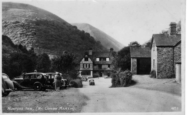
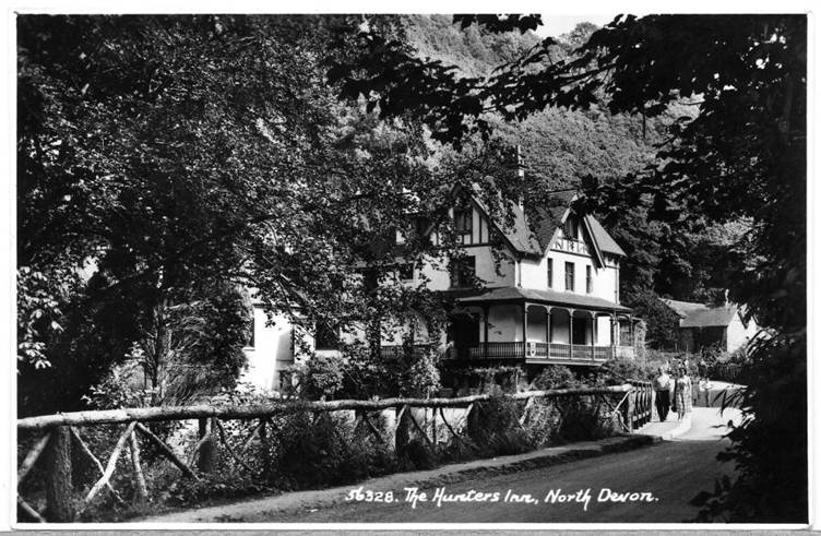
From the car parking spot head straight towards the pub. The Hunters Inn has stood here since the eighteenth-century serving farming families and travellers moving through the valley. The original thatched inn burned down, and in 1906 the present building rose in its place, designed in the Swiss‑chalet style fashionable when Lynton and Lynmouth were marketed as “Little Switzerland.”


Leave the inn and take the track on its right-hand side. When the path splits, fork to the left, to meet the course of the River Heddon. The little stream is home to brown trout and, at times, otters while the valley floor is filled with hazel, oak, and riverside meadows.

Climb up through the trees, between old boundaries and back down to the river. Ignore the stone footbridge as the valley tightens into Heddon’s Mouth Cleave, a steep-sided gorge where the river grows louder. The slopes rise sharply either side, climbing up to over 200 metres. Stay on the lower path where up on the eastern peak sits the remains of a Roman signal station. Its position, high above the river, facing the sea, suggests it may have been a strategic lookout.


Turn left over the footbridge to head to the beach, where the sound of the waves begins to overpower the river. Slowly the valley begins to open, with glimpses of the sea. The path ends at Heddon’s Mouth, a wide cobbled beach approximately 300 metres wide, accessible only by footpaths. Sitting on the shoreline are the remains of a nineteenth‑century lime kiln, the lime once burnt for agriculture and building.


The cove itself is almost invisible from the sea, the high rising cliffs and large boulders camouflaging its entrance. Smugglers once used Heddon’s Mouth as a landing place, making the Hunters Inn a refuge for those who knew how to move quietly through the valley. In 1885, as recorded in The Times newspaper, a Mr E. D. Weedon received the Royal Humane Society’s Bronze Medal for saving a life at Heddon’s Mouth. In 1923, a pleasure steamer with 400 passengers broke its rudder and drifted out to sea before being towed into the cove and safely landed.


During the Second World War, as the Heddon Mouth was so remote, a German U‑boat surfaced and sent a landing party ashore under cover of darkness. They rowed into the cove, filled water cans from the River Heddon, and enjoyed a respite from their underwater world, smoking and stretching their cramped legs. No one walked the gorge at night, and the Hunters Inn slept on, unaware that enemy sailors were only a mile away. After an hour or so, they pushed off again, rowing back into the blackness where the submarine waited. By dawn, they were gone, leaving nothing but footprints on the stones and a story that would surface only years later.


After exploring the beach, retrace your steps back to the footbridge. Do not cross and instead stay on the same path. Weave with the western route back through oak woods while the river flows past on the left. Continue straight ahead when the path splits, keeping to the higher track but still deep in the valley. Ignore the coastal path on the right to then curve through the trees as The Hunters Inn flickers between the trunks. On arriving back at the road, the option is to either return to the pub to the left or continue the walk up the river valley.


To continue the walk, turn right and walk alongside the cottages. Stay on the bottom road and veer off onto a track to the left. Turn left over a footbridge, right off the drive, cross over a track then turn sharply left into Trentishoe Woods, climbing steeply out of the valley. As you approach the top, curve with the track into Invention Wood, following its border up to the peak. Leave the trees through a gate and bear right over the field to a gap in the hedge, sea views appearing on the right. Turn left and follow the field boundary to the next fence where the path continues up to Heale Down. Turn left down to Heale Woods.


Heale Down is a landscape of heather, gorse, and wide-open skies, known for its stunning moorland scenery. To the south, just below the highest point, stands a Bronze Age standing stone at 1.3 metres. It has been long debated to be either a rubbing post or a prehistoric marker. Further up the valley lies Voley Castle, a rare slight univallate Iron Age enclosure with an outer earthwork. Again, its purpose is debated whether it be a defended farmstead or a fort. Nearby, on the opposite side of the valley below the summit of South Down, stands Beacon Castle, another Iron Age defended settlement with a single rampart and ditch. Its position suggests it was picked for shelter from prevailing winds as well as long-term pastoral use, rather than any form of defence.


Drop down to the bottom of the field and through a gate into the trees. Climb carefully down the old track that has been carved, and grown into, the landscape due to centuries of use. At the junction with a wider track, turn left, signposted for The Hunters Inn. Join another track coming from the right as the river below continues upstream to the little village of Parracombe, home to a Norman motte and bailey castle. Holywell Castle guarded the junction of trade routes and perhaps supervised silver mining near Combe Martin. Built in the late 11th or early 12th century, the village grew to the northwest of the castle into the largest Devon village on Exmoor, with two churches one 19th century and the other 11th century. The oldest church has been constructed from walls that are 6ft thick while scatted around the building are apotropaic marks (to keep witches and evil spirts away).


Follow the track downstream with Tucking Mill, sitting on the opposite banks. Exit out onto the road and turn right to return to the Inn, turn right again to arrive back at the car park and your vehicle.