

In collaboration with The Dorset Wildlife Trust
Circle around the nature reserve of Kingcombe. Once a small farming hamlet, untouched by modern development and agricultural chemicals, it has become one of Dorset Wildlife Trust’s most treasured reserves. Climb up the valley past a thatched farmhouse and lost cottages to St Mary’s Lane, crowned by the spring that gave the lane its name. Discover the remains of Second World War defences, where the Home Guard once manned searchlights over the valley, before dropping down through the old medieval field patterns to the River Hooke. Cross the little stream and explore the old common, filled with wildlife at every turn of the season, to return along the holloway of Mount Pleasant Lane.

Distance: 2miles/km
Duration: 1 hour
Ability: Easy.
Max height: 540ft
Min height: 407ft
Total climb: 239ft
Terrain: Tracks, paths, fields, roads and a ford (wellies required). There is an extensive outdoor ‘exploration area’ suitable for mobility scooters when ground conditions permit at the Kingcombe Centre.
Map: OS Explorer 117 Cerne Abbas and Bere Regis
Start Point: The Kingcombe Centre. (Postcode: DT2 0EQ, Grid Reference: SY554990, What Three Words: forgotten.rental.being).
How to Get There: From Dorchester, travel northwest on the A356. Make your way through Maiden Newton, up the hill the other side, passing the turning to Toller Fratrum and take the next left towards Toller Porcorum. Take the first right onto Kingcombe Road and after a mile turn right to enter the Kingcombe Centre.
Dogs: In accordance with the Countryside Code and any notices on route. On leads throughout the Nature Reserve.
Refreshments: At the start and finish of the walk is The Kingcombe Centre. Opening times: Wednesday–Friday from 10am to 3pm, and Saturday–Sunday from 10am to 3:30pm.
Toilets: Available at The Kingcombe Centre
Neighbouring walks: The Kingcombes, Evershot, Cattistock, Toller Porcorum, Maiden Newton, Powerstock Forest, North Poorton and Hooke.

Walk
Nestled high in the valley of the River Hooke, squeezed between rising slopes and winding country lanes, is the hidden hamlet of Kingcombe. This secret pocket of unspoilt countryside was worked by the same family for generations, becoming known as ‘The Farm that Time Forgot’.

Kingcombe was first mentioned in the Domesday Book as part of the wider manor system of Toller, a small agricultural holding set within the wooded, stream‑cut valleys of west Dorset. Through the medieval period it developed as a dispersed farming hamlet centred on its mills, meadows and coppiced hillsides, with the River Hooke providing both water power and fertile grazing. By the seventeenth and eighteenth centuries Kingcombe had become a patchwork of small farms and estate cottages, but the nineteenth century brought enclosure and the gradual decline of water‑powered milling, leaving Kingcombe increasingly isolated and largely unchanged.

In 1985 the last owner, Arthur Walbridge, died at the age of 90. At the time, the farm was in a dilapidated state with only a scattering of ruins and two habitable cottages. The roughly 640-acre estate was split into fifteen lots and put up for auction in 1987.

The landscape had escaped much of the agricultural intensification seen elsewhere. Grazed only by sheep and cattle for centuries, free from artificial fertilisers and pesticides, and anciently split by thick hedgerows, sunken green lanes, ponds and the River Hooke, it created a historically preserved environment suitable for a plethora of both flora and fauna. The huge variety of plants formed an ecosystem supporting birds, invertebrates, mammals and fungi at a time when they were/are becoming increasingly rare.

This unique setting attracted the attention of the Dorset Wildlife Trust. A successful campaign was launched to raise funds and buy the land, publicised nationally through the BBC Today programme and The Daily Telegraph, and several lots were purchased. Over time further funds have been raised enabling the opportunity to buy further lots. Today The Wildlife Trust owns 467 Acres (189 hectares/250 football pitches) which straddles the River Hooke, and it remains a working landscape, managed through grazing, hay-making and traditional land management for both farming and wildlife. The Daily Telegraph now ranks Kingcombe Meadows as one of the top 10 places for a spring walk in Britain (number three to be precise!).
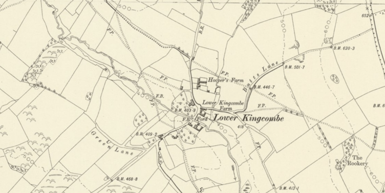
The Kingcombe Centre was built from a dilapidated barn and provides a hub of information about the reserve, old farming techniques and the neighbouring DWT reserve of Powerstock Forest. The Cow Shed is available for visitors to stay, while other buildings have also been adapted into the modern-day set up. Fishermen’s Cottage once stood in the farmyard, now the car park, and was believed to have been built upon the remains of the old Kingcombe Mill. As part of a wider attempt to understand the settlement, an archaeological investigation took place at Lower Kingcombe in 1988, formally recording Kingcombe as a shrunken medieval hamlet.

The reserve itself never closes. The café, operating in the summer months, looks over the wildlife garden while surrounding the centre are a number of other attractions including the kitchen garden, wildflower nursery, playground, orchard and insect hotel sculpture. After quietly sleeping during winter, the area comes to life in spring. In May the UK’s rare dormouse emerges after hibernation, hopping from tree to tree to satisfy its hunger. In summer the air is filled with butterflies as they dart between the meadow’s flowers. In June the Bee Orchid blooms and throughout the nights of July the barn owls glow in the moonlight as they flash through the sky.

Leave the centre and turn right along the country lane to cross the River Hooke, using the brick bridge that replaced the old ford. On the right stands Sunnyside Farm, with a date stone of 1888. It sits below a small junction of tracks, where the old valley path has long since been trumped by the lane, reducing it to the status of a farm track. Like Fisherman’s Cottage, Sunnyside is believed to have replaced an earlier building, showing a continuation from the medieval hamlet into the later farming community.


Continue up the road to pass the 16th‑century, thatched Lower Kingcombe Farmhouse. The house has undergone several alterations over the centuries, suggesting a level of security and prosperity that allowed its owners to invest repeatedly in the property. Dorset butter and Blue cheese were produced here, and with the arrival of the railway in the 19th century even this small, secluded valley could send its farming produce to wider markets, including London. The connection broadened Kingcombe’s reach without changing its character, leaving it a modest farming hamlet rooted in its historic landscape.

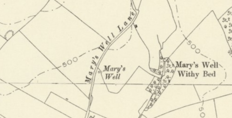
Opposite the farmhouse gate is a small water conduit, supplied by a well higher up St Mary’s Well Lane. It bears the letter S, marking the estate of the Earl of Sandwich of Mapperton House, who owned the Kingcombe lands during the 19th century. The conduit provided an essential supply of clean water for the people living and working on the surrounding farmland.

Continue up the road to Dairy House Farm (also known as Hooper’s Farm), rebuilt in 1989, and Beech Cottage, rebuilt in 1997. Both were restored by the Trust and, like the Cow Shed, are available as self‑catering properties. It is thought that they each originate from earlier medieval buildings.

Climb the hill to meet St Mary’s Well Lane as Kingcombe Road bends to the left. Once standing on the junction were the cottages of Fanny Sprake and Lottie Davies, neither of which survived the test of time, leaving only scattered, hidden foundations. The 1881 census records Frances, aged 69, was widowed and working as a midwife. Although her house has vanished, a yew tree still grows in what was once her garden. Lottie is remembered in the name of the junction, now known as Lot’s Corner.


St Mary’s Well Lane is one of the many old tracks that once connected the surrounding farmland to the valley. The well sits halfway up, on the southern side of the track, and is now little more than two capped concrete structures. On the northern side, the fields are marked with medieval strip lynchets, consisting of around 62 acres (25 ha) of long, parallel terraces that reflect centuries of cultivation, as well as reinforcing the historic importance of this little lane.


Stay on the valley road to pass the remains of Second World War Nissen huts on the left. Although Kingcombe itself was remote, the valley sat within a wider landscape of intense wartime activity. Units of the Scottish, Sussex, Highland and Durham Light Infantry were stationed at Toller Porcorum, using the surrounding hills and lanes for training, manoeuvres and night exercises. Searchlights are believed to have been positioned, managed by the home guard, both at the end of Toller Lane and here beside the huts, taking advantage of the open valley floor and the elevated ground above it. The surviving concrete bases, rusting fixings and bricks are now the last physical reminders of a brief but significant military presence that temporarily disturbed Kingcombe’s otherwise peaceful farmland.


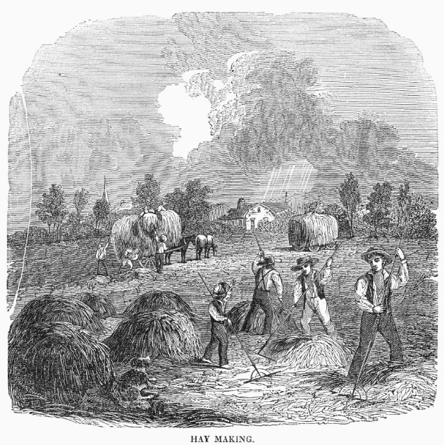
Continue along the road between Lady’s Mead and Lord’s Mead, hay meadows that lie directly over the medieval strip lynchets. These long, parallel lines, first carved by ox‑drawn ploughs, have since softened into narrow meadows, while the road that cuts between them is now enclosed by thick hedges. Haymaking was once a major annual undertaking. The grass was cut by hand, turned to dry, gathered into temporary cocks and finally carted home. The name mead simply deriving from this process.
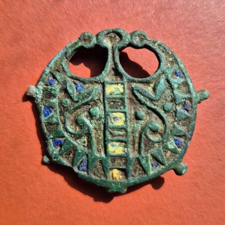
On approaching the brow of the hill, take the next left, through the farm gate, onto Lord’s Mead and bear left to the bottom corner. Modern archaeological work around Kingcombe has revealed faint rectangular earthworks beneath the medieval terraces. These subtle platforms and boundary lines suggest that this slope was already being farmed in the Iron Age and continued into the Roman period, with medieval farmers simply reusing or modifying the much older field systems beneath them. Although no major excavation has taken place, stray finds from the wider Hooke valley, including Iron Age pottery fragments, Roman coarse ware sherds and a small bronze Roman brooch, are held in Dorset Museum.

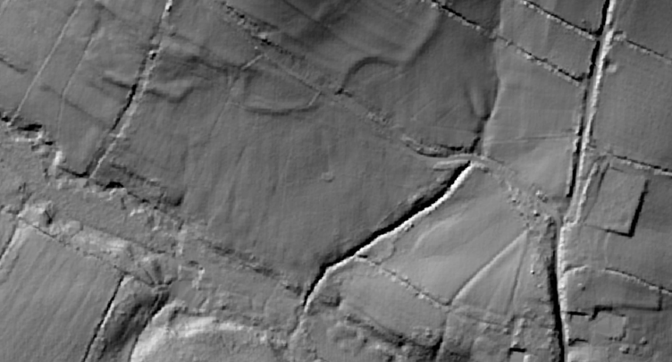
Cross over the footbridge and bear right over the Moor, where faint platforms and holloways mark the remains of the medieval shrunken settlement, the meadow rising back up to Beech Cottage.

Head through a gate onto another bridge over the water. The river, rising only a few miles upstream, at the village that shares its name, flows south to Maiden Newton where it joins the Frome. It is the river that shaped this landscape by nourishing the meadows, supporting livestock, and determining where people could build, farm and move through the valley.


Along this stretch, archaeologists have looked for signs of historic water management, including the possible remains of a mill‑pond or fishpond that fed Kingcombe Mill. Although the structures themselves have long vanished, subtle earthworks and changes in ground hint at the old system of channels, leats and pools.


After crossing the bridge and following the boardwalk up the steps, you have the choice to either return to the Kingcombe Centre by turning left or to continue on a loop around the reserve.

To start the loop, bear right, through the field and thick hedge to enter Cowlease. The southern fields have a noticeably different character from the northern hay meadows and are interpreted as later enclosures, possibly carved out of former common or waste ground. Field names often preserve memories of how land was once used, owned or divided long after the original purpose has faded. In this case, “lease” suggests land that was leased out by the estate rather than held directly by the farm. Such parcels were often marginal or newly enclosed areas, rented to tenants for grazing or seasonal use. Cowlease may therefore record a time when this part of the valley was managed separately from the main farm, its boundaries formalised only when the common land was divided and brought under tighter agricultural control.

Follow the trodden path to cross a small stream and up through a farm gate on the left. Turn left, climbing up *** through the next hedge into New Grafs Ground, the name “new” hinting at a later addition to the farm. Curve gently left on a faint track to enter the, now familiar, pattern of long, narrow fields. Pass through Cleall’s Mead, straight through Middle Mead and onto Coarse Mead, all consistent with the earlier ploughland. Higher up the slopes lie Banger’s Common, Nichol’s Common and Beal Common, their names preserving the families who once held the newly divided common land. The Banger family appear in 18th‑ and 19th‑century Toller Porcorum records, the Nichol (or Nicholls) family is a long‑established Powerstock and Toller surname, while Beal is recorded in the 1840s tithe apportionments.


When in Coarse Mead, curve around to the right, up the hill, to find the memorial stone to Richard Jennings (1935-1989) who played a key role in securing Lower Kingcombe Farm for the Dorset Wildlife Trust in 1988.

Wrap around the stone to turn left. Ignore the gates on the right and instead follow the holloway down through the trees known as Mount Pleasant Lane. This lane is an old drove road linking the valley to the higher common. The name Mount Pleasant appears frequently across Dorset and the wider country. Despite its romantic tone, it is sometimes associated with medieval dumping grounds, but more often relates to a pleasant rise of ground, such as a dry, breezy slope above the valley floor.

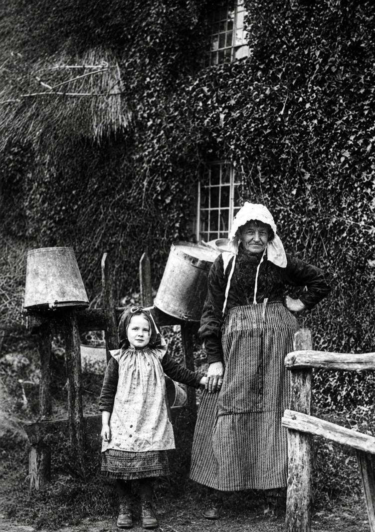
Weave around the trees that have now taken control over this little routeway to the bottom. Head through the gate to join the harder track and follow it down to meet Kingcombe Road at Cleall’s Corner. Like Lot’s Corner, across the valley, a small cottage once stood at this junction, in this case belonging to Mrs Cleall (most likely tenants of Cleall’s Mead) in the late 1800s. Foundations and a possible doorway survive hidden deep within the vegetation, but her presence is one of several reminders that Kingcombe’s history is unusually rich in women’s stories. While many rural landscapes record the names of male farmers, tenants or landowners, Kingcombe has also preserved the memory of the women who lived and worked on its slopes alongside them: Mrs Cleall at this corner, Lottie across the valley and the midwifery of Fanny Sprake, while others still survive in field titles and oral history.


Merge straight onto Kingcombe Road, then take the next right up to Kingcombe’s overflow car park and the renovated self‑catering property of Pound Cottage. The car park now occupies the old enclosure of the village pound, where stray livestock were once held until their owners paid the required fees. From here, re‑enter the gardens of the Kingcombe Visitor Centre on the left and meander through the displays to return to the main car park and your vehicle.


