

Wander beneath the thick canopy of Wareham Forest, following the Sika Trail toward Wareham itself. Cross the railway tracks to reach the River Piddle, where a 15th-century bridge carries you over its quiet waters. Climb the hill to discover one of the most remarkable Saxon churches in the country, then descend along the ancient Saxon walls back into the valley of the River Piddle. Wind through the floodplains to West Mill, pass beneath the railway bridge, and return to the forest, skimming the rediscovered gardens of Carey House, all in the footsteps of a saint’s funeral entourage.

Distance: 4 miles/7.5km
Time: 2 hours
Ability: Easy.
Max height: 153ft
Min height: 12ft
Total climb: 192ft
Terrain: Tracks, paths, fields, and roads. (The River Piddle can flood in wetter months. Please check water levels. A diversion can be followed on the map)
Start Point: Sika Trail Car Park. (Postcode: BH20 4DH, Grid Reference: SY906893, What Three Words: whites.novelists.starts).
Map: OS Explorer OL15 Purbeck and South Dorset
How to get there: Cross over the River Piddle on the northern edge of Wareham and then straight over the railway. Take the first left at the next roundabout, then right at the station onto Bere Road. Enter Wareham Forest to find The Sika Trail Car Park on the right after about a mile or so.
Dogs: On leads where livestock is present and in accordance with any notices on the walk and The Countryside Code.
Refreshments: None on route but nearby is The Angel (The Silent Woman) – newly refurbished. There are also a number of options in Wareham.
Neighbouring Walks: St Edward’s Way, Wareham Forest, Gore Heath, Wareham, Ridge, Stoborough, East Holme and Woodbury.

Walk
The name Coldharbour (Cold Harbour) appears in many locations throughout the county. Of Saxon origin, it means exactly what it implies as a “cold” or abandoned place. These sites are typically found outside main towns, often in areas that show signs of earlier activity or remnants of ancient settlements, where travellers sought refuge. In the case of Coldharbour near Wareham Forest, along old trading routes from the River Frome, the name may also refer to an abandoned cottage or hamlet now reclaimed by the trees. Cold Harbour remains tucked beneath dense woodland, featuring just a few campsites and The Angel. For the past half century the pub was known as The Angel until the 1920s when the name was changed to The Silent Woman. This was due to a local legend involving the landlady who revealed the secrets of the local smugglers and, in retaliation, they cut her tongue out. In autumn of 2025, the owners, Hall and Woodhouse, renovated the building, returning it to its original name.

From the car park, enter the woodland to meet junction of tracks. Bear slightly right following the gravelled route of the Sika Trail to Northport, between the tall fir trees. Managed by the Forestry Commission, for both conservation and recreation, the forest’s unique ecology supports a variety of rare species and has earned the designation of a Site of Special Scientific Interest (SSSI). The sandy soils and low-lying heather and gorse create ideal conditions for all British reptiles, including the adder, smooth snake, sand lizard, and slow worm. The heath also provides a haven for ground-nesting birds such as the nationally scarce Dartford Warbler. Sika deer graze on the abundant heather and grasses, giving the Sika Trail through the forest its name, while dawn and dusk in summer offer opportunities to spot nightjars hunting for insects


After just under a mile, having crossed straight over the passing tracks, drop gently down the hill to reach the southernmost point of the forest. Curve to the right to leave the trees and merge onto a channelled path between the golf greens of Wareham Golf Club, founded in 1908. Continue over the golf tracks, still heading into Northport, for the heathland paddocks to open up on the left. The area was heavily used during the First and Second World Wars as a military training site. A Second World War Heavy Anti-Aircraft Battery, operational between 1940 and 1944, were visible as buildings, structures and earthworks on aerial photographs taken in 1945, but the features have since been demolished and built over by modern housing development. There are also remains of slit trenches and fox holes but obscured by modern plantation.


Skim Tatinoby Farm, following the route of the Northport Greenway and Woodlark Trail, which provides a safe walking route from Wareham Quay to Wareham Forest via the Railway Station. Cross over Northmoor Way onto Burns Road and, at the end, head straight into Northmoor Park. Keep to the left of the playing fields around the playground to the join Tatinoby Lane. Cross over Northmoor Way for the second time and follow the footpath into the trees. Emerge at the roundabout and cross straight over the road. Turn left to the train station, or, if the River Piddle is in flood, turn right then left onto Carey Road and when it bends continue straight ahead onto the track to re-join the walk at Ferncroft Farm.


In 1844 Wimborne solicitor Charles Castleman founded the Southampton & Dorchester Railway, bringing the first official railway into the county. It followed the coast from Southampton up through sparse heathland to Brockenhurst in Hampshire and on to Dorchester via Ringwood, Wimborne, and Wareham. The station was originally built to the east but when the Wareham to Swanage branch opened in 1886 the station was moved and rebuilt in 1886 in its current position.


Cross over the railway bridge onto Northport Road, opposite the old Railway Hotel, and turn right towards the next roundabout. The road once led all traffic into the town but was trumped by the bypass in 1973. Stick to the pavement as it diverts to the right and drop down under the main road. Climb up the other side to meet the River Piddle and the North Bridge that crosses its flow.


The River Piddle travels for eighteen miles from the high hills of the Dorset Downs at Alton Pancreas to flow through the flat-water meadows of its flood plains, at the base of Wareham Forest. A bridge had first recorded here in 1483, superseding a drawbridge from a medieval landscape. It was rebuilt and extended in the 17th century and widened in the 19th century and still used by the modern traffic today.


Head straight up the road to pass through the Saxon defences and up to St Martin’s Church on the left. Nestled between the River Piddle and River Frome, Wareham dates back to the Saxons, who founded the settlement in the 7th century, its strategic location, protected by marshes and rivers, made it both a sanctuary and a target. It is believed St Aldhelm established a nunnery here and built St Martin’s Church, giving rise to a village known as ‘wer ham’ translating to the settlement by the weir.

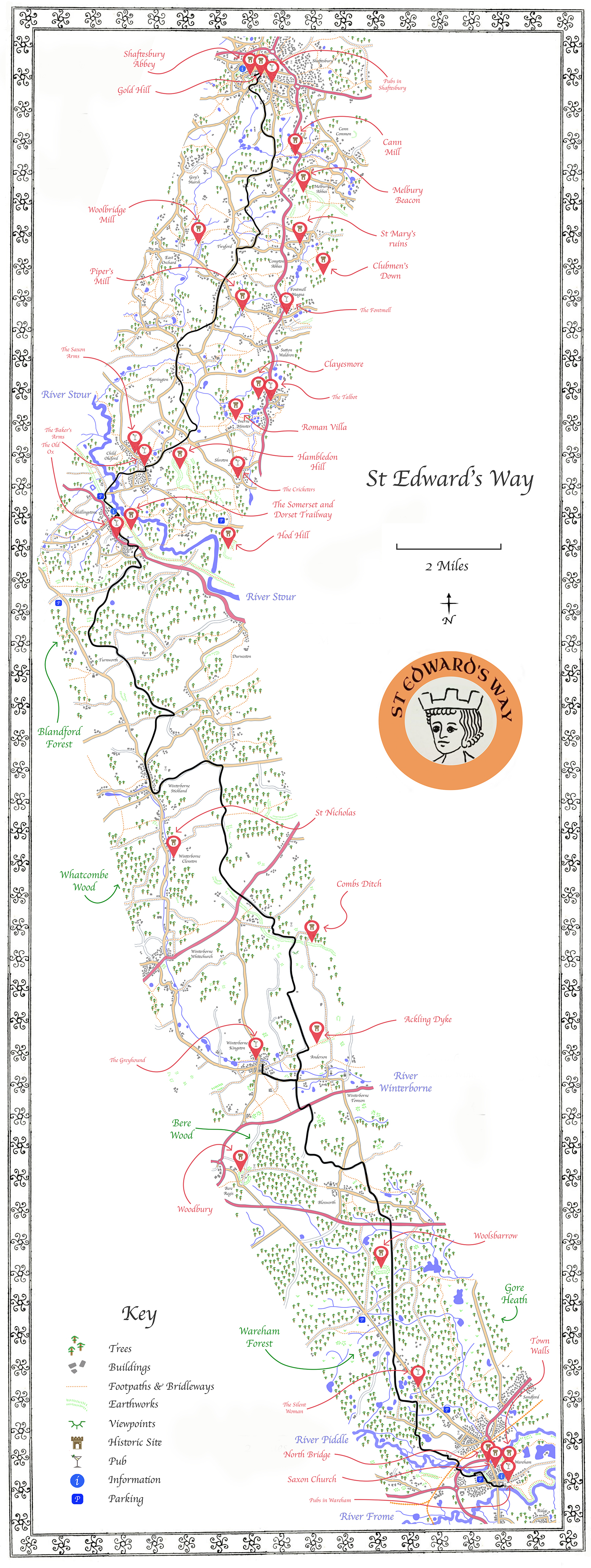
Throughout its history, Wareham has seen some dramatic events including many Danish invasions. In the 9th century the town was captured but was reclaimed with a treaty by Alfred the Great who then fortified the Saxon stronghold into a burh, lifting the large earthen banks up around the town and topping them with wooden stockades. Wareham proceeded to grow into a thriving market town with its own royal mint and in 978AD Edward the Martyr, a Saxon king, was buried in St Mary’s Church until he was moved to Shaftesbury Abbey. The boy king had been murdered possibly on the orders of his stepmother at Corfe Castle, and his body became an object of pilgrimage. The route his body took between the two towns has become its own pilgrimage path, developed by the Dorset Ramblers and known today as St Edward’s Way.
With the arrival of the Normans, a castle was erected in its southwest corner overlooking the river Frome, although this was later abandoned in favour of Corfe Castle. The town’s fortunes, created by its little harbour, were shifted by the rise of nearby Poole during the 13th century, but Wareham remained a vibrant community. In 1762 a devastating fire led to a rebuild in Georgian and Regency architecture and the settlement then gained the railway a century later. Today, it is a charming market town, rich in history and character, with a population of about 5,900.

Cross the road to find some little steps taking you up to the church path on the left. St Martin’s Church is Dorset’s most complete late-Saxon church and stands as a testament to the town’s resilience. It guards the northern entrance, strengthening the defence but welcoming the travellers. The original building was destroyed by Vikings around 1015 and rebuilt when King Cnut converted to Christianity with the east chancel and the north and south walls of its narrow nave dating from this initial period. Over the centuries, St Martin’s fell into neglect and by 1736, it was only used for marriages and christenings, remaining largely forgotten for nearly 200 years. It was restored in the 20th century and will soon celebrate its 1000th birthday. Inside is a tomb effigy of Lawrence of Arabia, a unique tribute to the legendary figure who lived nearby, carved in 1939, four years after his death, by sculptor Eric Kennington.


From St Martin’s Church drop back down the hill and turn left to climb up Shatter’s Hill. Take the next right, opposite Mill Lane, to cut down though Wareham’s walls into the valley. The Walls of Wareham, consisting of massive earthen banks, are still a striking defence, however the defences to the south, where it borders the River Frome, little is known. It is a possibility that they grew from older roman town walls, as a roman fort is believed to have been the first settlement on the land between the rivers, with evidence unearthed from the Iron Age through to the late 3rd and 4th century from beneath the ramparts. When North Street was lowered in the mid-19th century, a hoard of Roman coins was found dating to the 1st century AD, strongly linking the town to the time of the invasion in AD 44. It can also be argued that a Roman road connected their fort at Wareham to the military road of Ackling Dyke, skimming the ramparts of Woolsbarrow and Woodbury Iron Age Hillforts, the road still cutting through the forest today.


Curve down to the 18th century Mill House. Cross over the brick bridge, which dates from the same period, and turn left onto Wareham Common, the River Piddle’s flood plains. Follow the river’s meandering course upstream as the walls rise in the opposite banks. When the walls turn away the old Union Workhouse, built in 1837, looks down from above. The conditions were deliberately made to be as harsh as possible and therefore discourage people from seeking help from the state, but it also faced early issues, including the builder’s bankruptcy, before it opened in 1838. It closed in 1948 and the building was turned into accommodation with a new hospital built on the neighbouring site.


Duck under the busy A351 bypass and emerge the other side to follow the grass track alongside the river to the 19th century West Mill and its bridges over the Piddle. Head under the railway bridge and curve to the right then left, following the route of both the Wareham Forest Way and the St Edward’s Way. Cross a succession of little bridges over the flood plains to then curve up to Ferncroft Farm.


Turn left before the barn (or right after the barn using the alternative path if the river is flooded) and through the second gate, still sticking to the Wareham Forest Way and the footsteps of St Edward’s funeral entourage. Weave with the path between the fields to enter the trees ahead then curve up to the right past the modern Garden Cottage.


Hidden down on the left, behind the original 1883 Clayton red brick walls of Carey House, lies Careys Secret Garden, an award-winning, wild walled garden that was rediscovered in 2019 and opened to the public in May 2021. Expertly restored with a focus on rewilding, permaculture, and natural gardening, this unique sanctuary welcomes a select number of visitors each Wednesday and remains a closely guarded secret due to its sensitive wildlife projects. The 3.5-acre garden’s heritage walls are now earmarked for official listing, while in the surrounding woods are many isolated older boundary stones.


Continue up through the woods to meet Carey Road and cross straight over. Head back into the trees to cut through a landscape of quarries and excavations on the right and little woodland cottages buried in the trees on the left. Pass under the pylon wires and when the path splits, take the right-hand fork, off the Wareham Forest Way and St Edwards Way, to arrive at Bere Road. Cross straight over to return to the Sika Car Park and your vehicle.


