

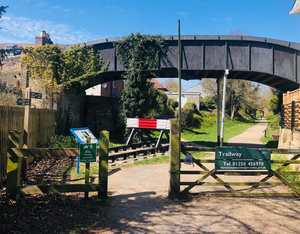
The North Dorset Trailway follows the route of the former Somerset & Dorset railway through the Blackmore Vale, linking Sturminster Newton with Blandford (and on to Spetisbury). Today, the railway has gone, but the route remains as an easy way to explore the countryside, villages and historic landscapes of North Dorset.

Sturminster Newton → Fiddleford
Fiddleford → Child Okeford/Bere Marsh
History
The old Somerset & Dorset Railway once carried steam trains through the Blackmore Vale and connected Dorset with the wider railway network. The railway opened through this part of Dorset in the 1860s, linking communities including Sturminster Newton, Shillingstone, Blandford and Spetisbury. It carried local people and goods, including farm produce and cattle, but it also became famous for carrying holidaymakers south towards Bournemouth.
For almost a century, trains passed through the landscape. Stations and halts served the towns and villages along the line, while bridges, embankments and cuttings carried the railway through the countryside. In March 1966, the final passenger trains ran and the railway closed as part of the Beeching cuts. The tracks were lifted and much of the route fell back to nature.
But, local people saw the potential for a new kind of journey, and after years of work by volunteers, landowners and Dorset’s countryside teams, the missing sections were gradually brought together. In May 2013, the continuous Trailway between Sturminster Newton and Spetisbury was opened.
The North Dorset Trailway is now part of Dorset’s Local Transport Implementation Plan 2026-2031, extending the Trailway as a priority for Northern Dorset. This will connect Sturminster Newton to Stalbridge in the north, and Spetisbury to Poole in the south. The aim is to create longer-distance walking and cycling routes, improve connections between communities and make greater use of the old railway corridor.
The railway may have disappeared, but its route continues to connect people with the landscape.
Route Breakdown
Distance: 9miles/14.5km (Sturminster to Blandford)
Walking time: Around 3–3½ hours, allowing for a steady pace and stops.
Cycling time: Around 1½–2 hours at a relaxed pace.
Ability: Easy. The Trailway follows the former railway formation, with generally gentle gradients and no significant climbs.
Accessibility: The Trailway is well known for its accessibility, with a largely level, firm route that makes it suitable for a wide range of users, including wheelchair users and those with mobility difficulties. Some road crossings and diversions away from the original railway formation require extra care.
Max height: 222ft
Min height: 113ft
Total climb: 354ft
Terrain: Tracks and roads. Mostly firm Trailway surface, with some sections where the route diverts onto roads or other paths.
Start Points: Sturminster Newton, Fiddleford, Shillingstone Station, Stourpaine, Milldown Nature Reserve, Blandford.
Map: OS Explorer 129 Yeovil and Sherborne, OS Explorer 118 Shaftesbury and Cranborne Chase
Dogs: Dogs are welcome. Please keep them under control around livestock and follow local signage. Please be aware of The Countryside Code.
Refreshments: A number of options are in both Sturminster Newton and Blandford, while just off the route sits: The Fiddleford Inn, Buzz Cafe at Bere Marsh Farm, Shillingstone Station Cafe, The Old Ox in Shillingstone, The Black Cat Cafe, and The White Horse Inn at Stourpaine.
Neighbouring Walks: Rolls Mill, The Swan, The Bull, Hazelbury Bryan, Child Okeford, Hambledon and Hod, Travellers Rest, The Crown and Bryanston
Following the railway south: Charlton Marshall, Crawford Castle, Sturminster Marshall, Charborough, Wimborne, Corfe Mullen and Lady Wimborne’s Bridge.
The Trailway can be explored in shorter sections, with access points at several locations along the route. It also continues beyond Blandford towards Spetisbury. This section isn’t included in this route, but the Trailway can be picked up again at Blandford St Mary if you want to continue south. Footpaths and bridleways can take people off the trailway to a number of other sites including woodland, riverbanks, pubs and hill forts.

Sturminster Newton → Fiddleford

The Trailway currently begins at Sturminster Newton, where the old railway route leaves the market town and heads south into the Blackmore Vale. Sturminster Newton makes a good starting point, particularly if you want to combine a stretch of the Trailway with a wander around the town, where you’ll find shops, cafés and pubs, as well as the River Stour and the town’s famous medieval bridge and mill.
Following the old railway formation, the path is broad, level and easy-going as it leaves the town behind and heads towards Fiddleford. Look out across the surrounding fields and you’ll begin to get a real sense of the landscape the railway was built to cross.
The first village you reach is Fiddleford. Just a short walk from the route is Fiddleford Manor, a remarkable medieval building dating from the 14th century. The manor is open to the public and free to enter, making it an easy detour from the Trailway and well worth allowing a little extra time for.
Nearby, the old Fiddleford Mill sits beside the River Stour, where the Trailway crosses the river, and there is also the Fiddleford Inn close by
Worth the detour: Fiddleford Manor, Fiddleford Mill and the River Stour.
Good to know: If you’re simply walking or cycling the Trailway, you can make Fiddleford a short stop. If you’re interested in history, allow longer — the manor and mill adding another layer of history to the landscape through which the railway was built.


Fiddleford → Child Okeford / Bere Marsh

Leaving Fiddleford behind, the Trailway continues south through the quiet countryside of the Stour Valley. On approaching Child Okeford, the route takes a short diversion away from the original railway alignment, passing through the landscape of Bere Marsh Farm. This is one of the more interesting stretches of the Trailway because the countryside here is not simply something to look at, but is being actively restored.
Bere Marsh Farm has been acquired by the Countryside Restoration Trust as its largest project to date. The Trust’s aim is to demonstrate how traditional and sustainable farming can work alongside nature conservation, restoring habitats and creating space for wildlife while continuing to farm the land. The farm and surrounding meadows are home to an impressive variety of butterflies, birds, wildflowers and rare mammals, making this a particularly rewarding section for anyone who enjoys watching wildlife.
Worth the detour: Bere Marsh Farm.
Good to know: The Trailway does not follow the former railway formation continuously through this section. The diversion around Bere Marsh is part of the current public route.


Bere Marsh → Shillingstone

After passing through the Bere Marsh section, the Trailway crosses the road beside the old railway bridge. This is no longer simply a relic of the former railway. Thanks to the work of the North Dorset Railway Trust, the bridge has been brought back into use as part of the railway restoration project and trains can once again cross it.
From here, the Trailway climbs gently up to the railway tracks, giving you an opportunity to see the restoration work up close. The tracks lead to Shillingstone Station, the only surviving station building along the North Dorset Trailway. The station is now the heart of the railway restoration project, with a small museum and café, as well as the restored station buildings and working railway.
Worth the detour: Shillingstone Station, railway museum and café.
Good to know: The station, railway buildings, museum and café make this one of the best places along the route to stop and imagine the Trailway as it once was, with locomotives, passengers and railway staff.The station and railway restoration are managed by the North Dorset Railway Trust. Check their current opening arrangements if you’re specifically planning to visit the museum or railway.


Shillingstone → Stourpaine

Leaving Shillingstone Station, the Trailway continues, passing behind the village, crossing over Holloway Lane, before reaching the Big Yellow Garden project. This community garden project has transformed an old piece of railway land into a productive space for growing, wildlife and wellbeing. Fruit and vegetables grown here are shared with local food projects, including the Blandford Food Bank and The Vale Pantry.
The Trailway doesn’t simply run in a perfectly straight, level line. It rises and falls around the railway’s former bridges and crossings, some of which have survived while others have disappeared beneath the landscape. After the garden project, climb up to Hodway Lane, where the bridge now lies buried under the road.
After rejoining the railway the landscape opens with Hambledon Hill and Hod Hill clearly rising to the north and west. These two enormous Iron Age hillforts are among the most striking landmarks in this part of Dorset, and they provide a constant sense of scale as you travel through the fields below. The route then crosses the River Stour for a second time, to enter a tunnel of trees.
As you approach Stourpaine, the Trailway leaves the old railway formation again and takes you into the village. This is a useful place to stop, with a pub and other village facilities nearby. Follow the signs through the village and past the church to pick up the Trailway once more.
Worth the detour: Hambledon Hill and Hod Hill.
Good to know: The Trailway diverts away from the original railway route in places around Stourpaine. Follow the signed public route rather than trying to follow the old railway alignment.


Stourpaine → Blandford

Back on the Trailway, you pass the site of the former Stourpaine Holt, one of the small stopping places that once served passengers along the railway. The route then drops beneath the main road before climbing gently back into open countryside.
The River Stour lies down in the valley to the right, while the parkland and woodland of Bryanston rise beyond it. The busy main road runs alongside for part of the way, but the Trailway remains pleasantly tucked among fields and hedgerows.
Another underpass brings you towards Blandford, with the Milldown Nature Reserve on your left. As you enter the town, the Trailway feels surprisingly secluded, sunken below the surrounding roads and activity. Blandford is a good place to stop, with plenty of pubs, cafés, shops and places to explore. The Trailway itself currently finishes just to the north-west of the town centre.
The North Dorset Trailway continues beyond Blandford towards Spetisbury, but, for now, head down towards the River Stour, finishing at the remains of Blandford’s final railway bridge. Just downstream stands Blandford’s earliest bridge, and the crossing that gave the town its name.
Worth the detour: The Milldown and the River Stour.
Good to know: The Trailway can be picked up again beyond Blandford St Mary if you want to continue towards Spetisbury.




For further information:
https://www.northdorsettrailway.org.uk/

I love your Facebook page, would it be possible to share some of your beautiful images on the North Dorset Trailway website page?
Thank you. Yes of course!